CAPE DISAPPOINTMENT
46.2898° N, 124.0604° W
John Meares may have been disappointed by his visit to this lush promontory located on the border line of Washington and Oregon states—as legend goes, the English sea captain was looking for the ocean estuary of the mighty Columbia, but thought he’d only discovered another bay when he reached the Cape in 1788, hence, its dispirited and mistaken moniker—but, we can almost guarantee that you won’t be let down by a visit. In fact, the Washington State Parks website sums up its thrills nicely: “Lighthouses stand sentinel atop windswept cliffs, sea smells waft up through the air, and waves collide with a crash where the Pacific Ocean meets the Columbia River below.”
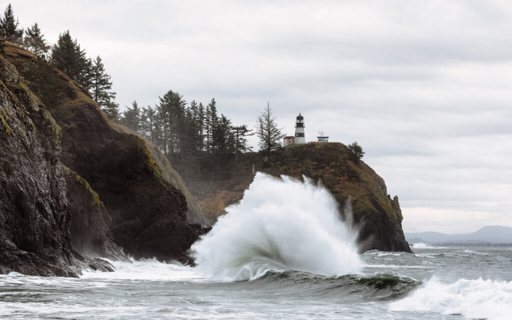
Yes, Cape Disappointment and its accompanying state park offer up a breathtaking spectacle of nature, with old-growth forests, freshwater lakes, saltwater marshes, and ocean tidelands all available to explore. The area is also steeped in history that goes beyond its name, as the Cape is also home to the Lewis & Clark Interpretive Center that celebrates the duo’s illustrious trek out West, and not one but two lighthouses, one named after the Cape and located near the Lewis & Clark Center, as well as the North Head Lighthouse, which is open beginning this month and on into fall to visitors.
Boaters would do well to begin their journey at Baker Bay. Located just inside the mouth of the Columbia River, behind Cape Disappointment on the north side of the river, this picturesque bay offers a boat ramp and 135 feet of docking space (be sure to grab a daily launch permit from the office or have your Discover Pass in hand). Alternatively, the Port of Ilwaco offers guest moorage in a bustling spot that offers direct access to the charming nearby waterfront town of Ilwaco.
Follow your bliss from there as you head towards the Pacific: Fishers love to set up on the North Jetty or near the famed Buoy 10, near the town of Ilwaco, to snag salmon or even crab in season; hikers can indulge in the eight miles of winding trails the park provides; kite-fliers, sand-castle builders, and clam-diggers can take their pick of the beaches (we recommend Benson Beach to those seeking clams); or, history lovers can head up the cliffside to take in the full range of exhibits found at the Lewis & Clark Center or spy the remnants of Fort Canby and the accompanying World War II-era battery that are still tucked into the rocky terrain. Experienced and prepared skippers could take a tour out to sea for incomparable views of the Cape Disappointment Lighthouse and a peekaboo look at Deadman’s Cove, before heading back towards Ilwaco. Our only advice is to call ahead to Serious Pizza on your return journey so that you can feast your eyes on yet another prize found near the Cape: the family-owned pizzeria’s piping-hot ‘za. (More info can be found at: parks.wa.gov/486/Cape-Disappointment)
CAPE FLATTERY
48.3831° N, 124.7144° W
Perched on the very northwesternmost edge of the contiguous United States, near Neah Bay on the Makah Indian Reservation, Cape Flattery transports you to a world teeming with marine life: Vibrantly hued sea stars cling to undersides of the rocks; cormorants and seagulls call from overhead; sea lions bask in the sometimes fleeting sunshine; and briny bivalves dot almost every inch of the beachscape that sits in between the 200-foot-high cliffs.
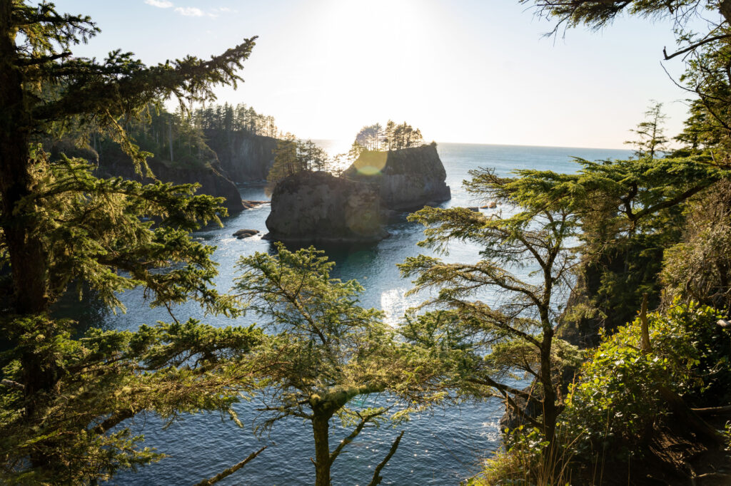
There are two ways to find your way to this Cape, both equally epic and enjoyable: Landlubbers can park at the Cape Flattery trailhead and enjoy the surprisingly accessible hike that winds its way to a jaw-dropping viewpoint. (Just don’t forget to purchase a recreation pass, available at most businesses in Neah Bay, including the marina, before you lace up those hiking boots; the area is under the management of the welcoming Makah people.) Your efforts on the .75-mile-long hike are rewarded with stunning views of the Pacific and Tatoosh Island, where the lonely 1857-era Cape Flattery lighthouse still stands watch over the waves that crash into the rocky shoreline from seemingly all directions.
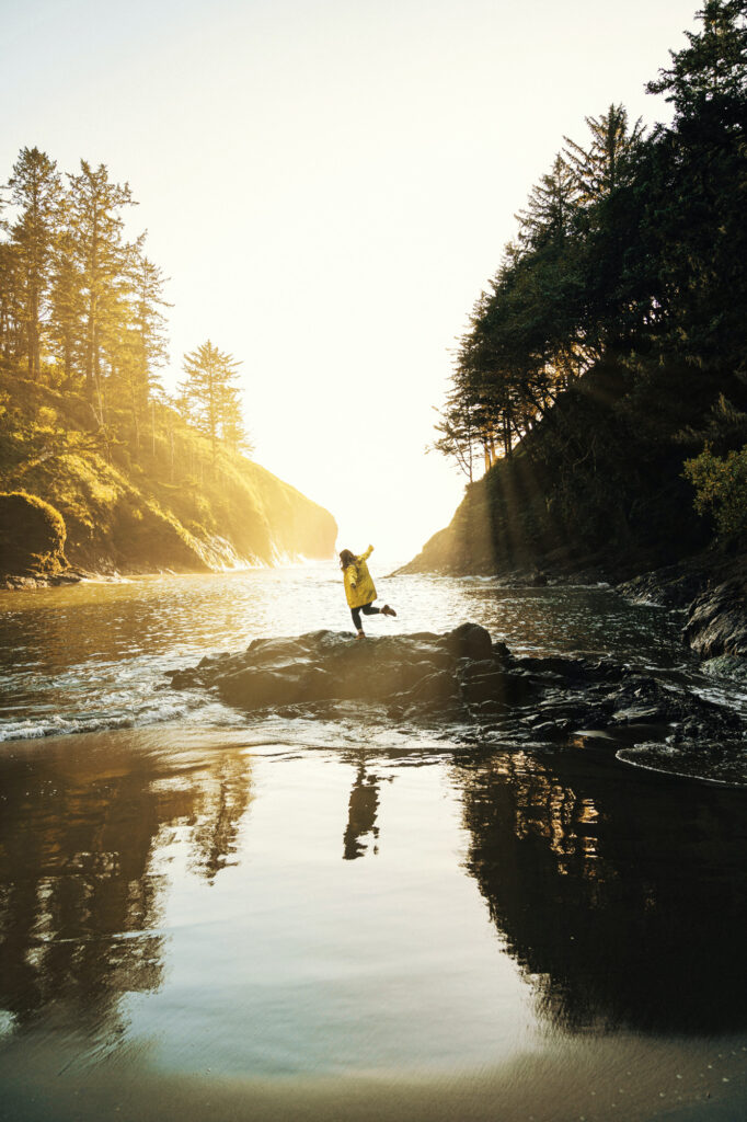
Or, you can drink up these same views from an entirely different perspective on the water. The nearest moorage to Cape Flattery is located at the Makah Marina in Neah Bay, which is well outfitted with 200 slips, or the friendly folks at Big Salmon Fishing Resort are only too happy to set up a charter boat to squire you about the sights, or a dedicated fishing excursion. Before leaving town, indulge in a crab feed, buttery halibut, or salmon-and-chips meal at Calvin’s Crab House, best enjoyed at one of the sunny picnic tables that overlook the serene bay. Sailing westwardly from the main town of Neah Bay towards the Cape, which is a 4-nautical-mile-long journey, you’ll pass by intricate inlets with pines stretching for the skies from their precarious perches; the truly ambitious could swing south past the Cape to journey towards the popular Hobuck Beach, or even further to Shi Shi Beach, which is home to the truly resplendent mile-long parade of rocky sea stacks. If you snagged a parking pass earlier in the expedition, you could alternatively also park at the Shi Shi trailhead and meander the trail to your just reward: views, upon views, upon views. (More info can be found at: makah.com)
CAPE ALAVA
48.1659° N, 124.7325° W
If you made the trek to Cape Flattery, here’s your next pit stop: Capa Alava near Ozette, which also lies within the Olympic National Park. While Cape Flattery takes the distinction of the northwesternmost point of the lower 48, Alava is the westernmost, putting you just that much closer to the precipice of the great blue sea. This stunning spot is perhaps most well-known as a coveted destination along the 9-mile-long Ozette Loop trail popular amongst hikers, but the beach is accessible via a shorter 3.5-mile-long hike from the trailhead or to the intrepid who brave paddling ashore. The aura of seclusion and intimacy looms large here as visitors are prohibited from going north of this spot into the Ozette Indian reservation, but the beach provides all the views you could ever want of tree-topped Tskawahyah Island. The amount of beachcombing you’ll do is dictated by the sea, as the westernmost point of the Cape is submerged by the high tide. Don’t forget to buy the appropriate passes available via the National Park system before setting forth. (More info can be found at: nps.gov/olym/planyourvisit/ozette-loop.htm)
CAPE SAINT MARY
48.4473° N, 122.8010° W
Located closer to home perhaps, on the eastern edge of Lopez Island, Cape Saint Mary provides a serene spot for a sojourn. Accessible only by the water, this petite Cape offers a small, rocky beach that boasts scenic vistas of the Rosario Strait, as well as pretty peek-a-boos at seasonal wildflowers and local wildlife like sea birds, deer, and otters. The best way to approach the beach is from the north at low tide, and given the rocky topography of the landing site, this is the time for your tender, canoe, kayak, or other shallow draft boat to shine. Preceding or succeeding your respite on the Cape, Lopez provides myriad other delights: Cape Saint Mary is located just one nautical mile due north of Watmough Bay, resplendent with its tranquil bay, wooded cliffs, and pebbly beach. Or, you can craft your own scenic cruise by sailing just a bit farther north of the cape and around Sperry Point to then glide by, in order: Cayou; Ram; Skull; Fortress; and Crab islands on your approach into the Hunter Bay County Ramp, where you can dock and then head ashore for a day hike or walkabout along the shore. Should you need to stock up on provisions or indulge in a tasty homemade meal, the charming Southend General Store and Restaurant is located a pleasant 2-mile jaunt down the road from the aforementioned Hunter Bay boat ramp, or just a half mile away from the hidden little haven of Mackaye Harbor and its boat ramp, located on the opposite, southwestern side of the isle. There, you’ll also find the Mackaye Harbor Resort, where you can hang your hat for the night should you wish to while away an additional day on the isle. (More info can be found at: visitsanjuans.com/lopez-island)