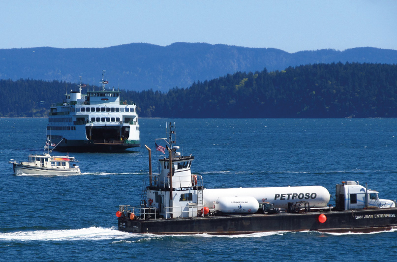
 We were just entering Thatcher Pass on our way to Friday Harbor one glorious summer day. Two Washington State ferries were in view off our bow at the same time, each cutting a clean wake through the unusually calm water.
It was a postcard moment, and I obliged it by grabbing my camera. As I watched the scene through the viewfinder, a horn blast startled me back to reality. Four more quick blasts of the horn put me into a mild panic. I turned around to see a third ferry, coming up behind us. We were in its channel.
I stupidly waved my hand as if the captain could see–or would care–that I acknowledged his presence. I made a turn to port to make room for him to pass. Tourists huddled on the rail to get a glimpse of the stupid boater who didn’t know better than to get in the way of a giant ferry. Again, I waved because I didn’t know what else to do.
Our day was just starting and already I had my fill of close encounters with the Washington State ferries.
Locals take the ferries for granted. They come and go all day long, every day of the year. Sometimes sounding their horn, sometimes not. Most people experience the ferry system as commuters or tourists. They think of the system in terms of wait times and ticket prices.
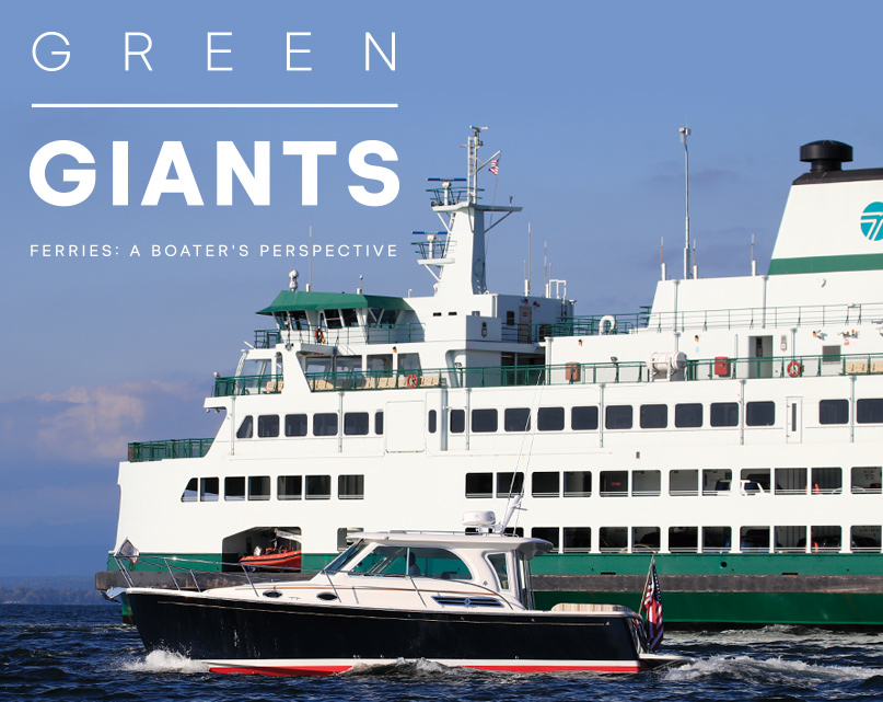
Boaters in Puget Sound have a different relationship with the massive green and white vessels. We see them from the water as we navigate near docks and across navigation channels. We hope to never hear the dreaded five blasts from the horn, alerting us and everyone around that we are in danger of being run down by a 460-foot ship.
The Washington State ferries are a fixture of our waterways, and they have always played an important role in our commerce, transportation, politics, and tourism.
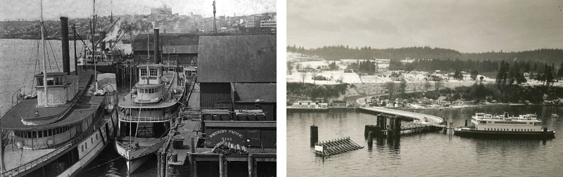
The current ferry system in Washington is the distant relative of the old Mosquito Fleet, which was made up of privately-owned steam vessels operating under one banner and plying the waters of Puget Sound and Lake Washington. In the mid to late 1800s, there were over 40 established steamship routes on Puget Sound, including the main route from Tacoma to Victoria.
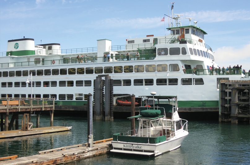
The Mosquito Fleet used several docks and wharfs in Seattle, including Colman Dock, which is still the downtown hub for ferries. Passengers could book passage to and from most waterfront communities, and several very long routes made it possible to avoid arduous overland travel in the days before the automobile.
One such route ran from Seattle to Hood Canal, a full day trip with stops in Kingston, Port Gamble, Seabeck, and Hoodsport, among others.
The proliferation of the automobile was the death knell for the Mosquito Fleet. A few ships converted to auto ferries, but as roads and highways connected waterfront towns, the need for anything other than cross-Sound routes diminished.
Shipping contracts with the postal service and other entities dried up, and while many boats held on well past their serviceable dates, the Mosquito Fleet slowly disappeared for good in the 1950s.
It was during the Mosquito Fleet years, however, that the modern ferry system began to take shape. Where there were once dozens of privately owned and operated vessels in the Mosquito Fleet, in the 1930s they were consolidated into two lines: The Puget Sound Navigation Company (known popularly as the Black Ball Line) and the Kitsap County Transportation Company.
In 1935 a labor strike took down the KCTC operation, and their vessels and routes were either abandoned or acquired by the Black Ball Line. A 1951 dispute with the state of Washington over raising fares led to the state purchasing the Black Ball Line, and the Washington Department of Transportation has been operating the ferry system ever since.
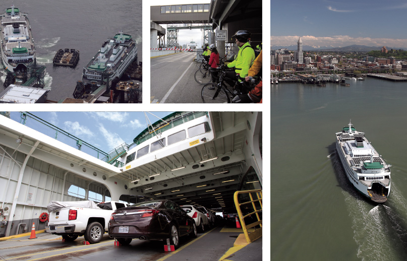
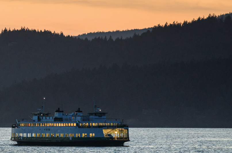
Interestingly, the state planned for this to be a temporary fix while a series of cross-sound bridges were designed and built. Those bridges obviously never came to be. Instead, a fleet of 22 ships connects waterfront communities from the South Sound to the San Juans and Canada.
Roughly 25 million riders use the ferry system each year, and it serves a wide variety of customers from daily commuters to tourists to commercial traffic. The routes are technically part of the state road and highway system. For example, the Edmonds to Kingston route is really just a section of State Route 104.
For that reason alone, it is crucial that the system function predictably and reliably. The center bay or “tunnel” of each boat is normally filled with trucks and busses carrying goods and people back and forth. On the San Juan Island routes, this is an absolute necessity. There is really no other way to get goods to the islands. Even on Central Sound routes, however, a ferry saves fuel and time compared to a long drive around the southern end of Puget Sound.
Daily commuters make up the vast majority of ferry riders, with the Edmonds to Kingston and Bainbridge Island to Seattle routes far outpacing all other routes in terms of ridership. Eastbound weekday morning sailings tend to be quiet affairs, with walk-on passengers drinking coffee, reading the paper, or getting a jump on their workday.
Of course, tourists and locals on vacation make up a large percentage of riders in the summer months and on holidays. It isn’t uncommon for wait times for cars to reach three hours on summer weekends. Anytime you are sailing near a ferry in the summer you can expect to be in the background of a number of snapshots.
The ferry system serves other functions beyond carrying cars and passengers back and forth. Each vessel in the system is equipped with weather monitoring equipment. For boaters, this is a very valuable service. The ferry system’s vessel tracking system provides real-time wind speeds. We use this to monitor weather systems and to make decisions about route plotting, anchoring, and even whether or not to leave the marina.
Many of the vessels are also equipped with instruments to monitor water temperatures and other data. Starting in 2014 with the Port Townsend to Coupeville route, ferries have been used to gather and report data on water circulation in hopes of better understanding currents, oxygenation, and salinity.
This all began as a partnership with the University of Washington and has since expanded. Using vessels for more than their express purpose increases their value to our region and waterways immensely.
You have likely heard about ferry crews assisting in rescues on the water as well. Crews will respond to reports of vessels in distress or man overboard calls. Crewmembers are trained in rescue techniques and regularly have drills to practice for just such an emergency.
I am one of those Puget Sounders who rides a ferry on a regular basis. Three to four times a week I am either on the Mukilteo to Clinton or the Edmonds to Kingston routes. I have seen a lot, and most of what I have seen from the captains and crew is quite impressive.
For example, a few years back on the Mukilteo to Clinton run, we left the mainland in a 40-knot southerly. Waves had been stacking up all morning in the long fetch from Seattle all the way to Possession Sound. Huge, rolling waves would have been right on the beam as we crossed, so the captain left the dock and turned south as soon as possible, taking the waves on the bow. Green water washed over the car deck. The windshield of my car took salt spray, even halfway back in the tunnel.
When the captain was ready, an announcement was made for everyone onboard to either stay in their vehicles or sit down. Then, having found a nice long wave, the captain executed a turn to starboard on the face of that wave, and we surfed our way down to the Whidbey Island terminal. It was as impressive a move as I have witnessed on any boat, let alone one that weighs in at over 4,000 tons.
For boaters, coexisting with the ferries is an important part of cruising Puget Sound and the San Juan Islands. Almost any trip north or south will mean crossing a ferry route. Many marinas are co-located with ferry landings, and the ferries use many of the same channels we do when getting from point to point. Because of that, it is important that we all learn to see the waterways from the perspective of a ferry captain and crew.
The first and most important thing to keep in mind is that these are commercial vessels that are protected by U.S. Coast Guard and Homeland Security rules. Generally speaking, stay as far away from any ferry you encounter as possible, whether that ferry is docked or underway. Make it very clear from your heading that you are not on a collision course, and remember that ferries generally have the right of way over recreational boats, especially in narrow channels and near docks.
While we tend to view ferries as part of the scenery, the captains and crew are quite attentive to us. On a summer weekend or during an active fishing season, a huge part of the crew’s job is watching out for us, trying to determine our intent and anticipate what sort of trouble we might cause them. The captain relies on the crew for a lot of input, in part because the view from the wheelhouse has numerous blind spots. A small craft too close to the side of a ferry is virtually invisible to the captain.
Like most large ships in Puget Sound, the ferries are deceptively fast, and a vessel that looks a long way off can be on top of you before you know it. They are deep-drafted (up to 18 feet) and have limited maneuverability, especially at low speeds. A ferry approaching a dock will be coasting for up to a quarter mile. Give them space. More space than you think you should.
The safety record of the Washington State Ferries is remarkably good, especially considering there are up to 500 crossings a day in the system. The few collisions on record are usually the result of a pleasure boater failing to yield right of way or simply not paying attention.
A video of a pleasure boat being hit by a ferry near Vashon Island made its way around the internet a couple of years ago. It is clear from the video that no one was at the helm of the pleasure boat when it happened, and the boat’s name—Nap Tyme—might give a clue as to what happened. The video highlights just how limited the large ferries are in their ability to avoid collisions. The lesson is, of course, to follow the rules and regulations at all times but also to never cut in front of a ferry underway.
It’s also advisable to avoid cutting in right behind a ferry. While you aren’t at risk of being hit in that scenario, the propwash of these giants creates a mess of whitewater, whirlpools, and waves. More than once we have seen small craft speed behind a ferry leaving the dock only to get tossed around and spun sideways once they get between the wakes.
Because we keep our boat in Everett, pretty much anywhere we want to go means crossing at least one ferry lane. We are more or less guaranteed to have an encounter with a vessel either leaving or arriving at the Mukilteo dock. Over time I have learned to estimate how long a ferry will remain at the dock so I can judge my chances of crossing the lane before they are underway, but they still often surprise me.
Ferries may leave at any time, regardless of their scheduled sailing time. Medical or police emergencies, for example, often necessitate a boat leaving the dock mostly empty.
Incidentally, this is when you see how fast they can be. Most larger ferries make crossings at between 14 and 18 knots, but when they need to do so, they can open it up and travel much faster than their nominal speed. Be aware! It is also worth noting that captains use their props to help hold the boat on the dock, so while they are loading and unloading there will be significant prop wash behind the vessel.
Should you need to contact a ferry, know that they do not monitor VHF channel 16. I won’t get into the arguments about this here, but just know that while some mates might have handheld radios that monitor 16, the bridge does not. To hail or be hailed by a ferry captain, monitor VHF channels 13 or 14.
Whenever we are approaching a dock or a ferry in transit we switch over. If you are in doubt of what you should do, contact the ferry. If you can’t see what vessel it is, you may use a generic call. For example, “Ferry leaving Kingston, this is pleasure boat Nap Tyme.”
In my experience they are quick to respond with information about their intentions or what they recommend you do to avoid interfering with their operation. A captain may also hail you to give you instructions or warnings. This is not terribly common, but it does happen. Don’t forget to monitor 13 and 14 when you are near docks or ferries underway.
Somewhere, there is a photographer with the quintessential Puget Sound image: an orca beaching in the foreground, framed by a white and green ferry against a backdrop of a snowcapped mountain range. The ferries are a part of our boating ecosystem and our relationship with them from the water is unique and special. Give them room and appreciate the role they play in our community.