


surveying easier than when done with large vessels.
At mean tide, our boat sits in her slip with about ten feet of water under the keel. At least she used to. Over the last couple of years, the water has become a little shallower. A few boats on our dock can barely get in and out of their slip at low tide anymore, as the marina slowly but surely fills with silt. Earlier this summer the signs went up at all the gates: Notice to Dredge.
The Puget Sound is a deep, fast moving maze of cold water, but everywhere a river or stream empties into it, everywhere currents meet and clash, and everywhere a bay comes to its head, suspended sediment falls to the sea floor. It just so happens that many marinas and navigation channels are prone to silting and must be actively managed to maintain navigable depths. To get our marina back to its reported depth will require the removal of 137,750 cubic yards of material. To put this into some perspective, your typical pick-up bed holds two cubic yards.
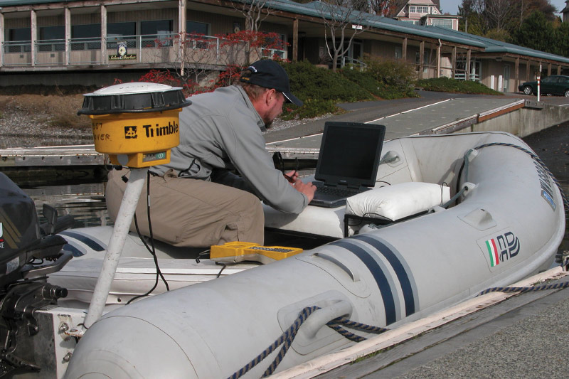
Briefly after seeing the signs informing boaters of the dredging, I noticed a small inflatable with several GPS antennae slowly and methodically working its way among the docks and boats. Laden with electronics, this turned out to be a workboat from Pacific Geomatic Services (PGS), the Mountlake Terrace-based company tasked with mapping the seafloor of the marina both before and after the dredging operation.
If you have spent any time on the water in the Puget Sound you have seen the results of this mapping work, if not the work itself. It is the sort of invisible task that is constantly happening to keep our waters safe and navigable. The reason those channels you navigate are as deep as they are supposed to be and the reason those buoys are located where the chart says they are is in part because companies like PGS are constantly at work locating, mapping, and monitoring our waterways.
Pacific Geomatic Services has performed marine navigation surveys throughout the region including marinas in Olympia, Tacoma, Des Moines, Seattle, Poulsbo, Edmonds, Everett, Oak Harbor, and Anacortes. They also recently set positioning for new navigational aids throughout the region ranging from Olympia to the San Juan Islands. Anytime you set a course or make a turn at a nun buoy, you are benefiting from the work marine mapping firms do.
Ron Hilliard, president of Pacific Geomatic Services (PGS), walked me through their equipment and the results they get from the data collected during a survey. With all the advances in recreational marine electronics, the line between your sonar or fishfinder and those used by professionals in the mapping industry is increasingly thin. PGS employs a variety of single-beam and multi-beam echo sounders along with commercial grade GPS locating to develop accurate maps of the seafloor. In confined places like marinas, multi-beam sonar allows the surveyors to “see” under boats and docks, where a typical down-looking, single-beam sonar cannot.
Mappers also need the ability to fine tune their equipment, as they are often working in tight channels, shallow water, or around structures and boats.
On the water with Hilliard’s crew as they mapped one of the basins at the Everett Marina, I was overwhelmed by the amount of data being collected. I was equally interested when they pulled out a lead line: the most old-fashioned depth sounder possible. Using the lead line on occasion allows the crew to determine the accuracy of the electronics.
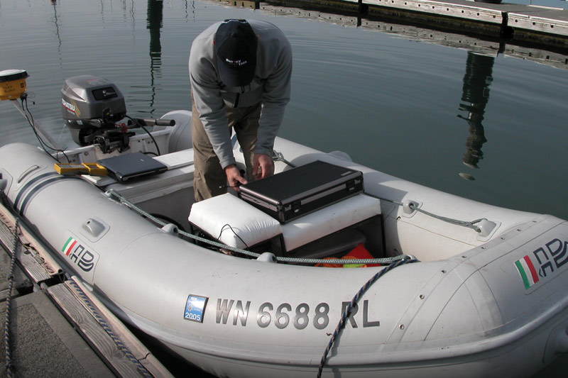
We slowly motored around the basin, following a grid pattern, capturing images of the bottom as we went. The end result is a detailed map of the sea floor, showing sediment build up, low spots, and other anomalies.
This year, PGS will map the entire Everett Marina. The data and imagery collected will help guide the dredging operations and determine where material should be removed. Then, once the dredging is completed in 2018, PGS will come back in and map the seafloor once more. In addition to the dredging operation’s estimates, the post-dredge survey is used to determine how much material has been removed.
It’s easy to forget that the Puget Sound is constantly shifting and changing. To maintain safe navigation channels and ensure that navigational aids are where they are supposed to be, companies like PGS are out there trying to keep up with the changes.
Left alone, buoys would shift, channels would silt in, and charts would become obsolete very quickly. Like most things, once you notice a survey vessel, with its multiple GPS antennae and other electronics, slowly plodding around a channel or marina entrance, you will start to see them everywhere. I asked Hilliard if he had anything recreational boaters should know about their work. Ideally, he said, his work is invisible and there is no impact to boaters. However, “boaters just need to realize that shoaling is regular and constant within the Puget Sound region and the work that hydrographic surveyors do is important to safe navigation in and around our waterways.”
He also said, “It’s important to give any working vessel plenty of room to maneuver. Often, they are moving at low speed with reduced steerage. If a mapping vessel is forced to deviate from their planned course, it can mean lost data or dangerous conditions for the crew. If you see a survey crew out working, slow down, throw no wake, and give them space to work. Without them, your cruising grounds could become un-navigable in a hurry.”