


[ legislation in action ]
Days Numbered for ‘Filthy Four’ Under New Derelict Aquatic Structures Law
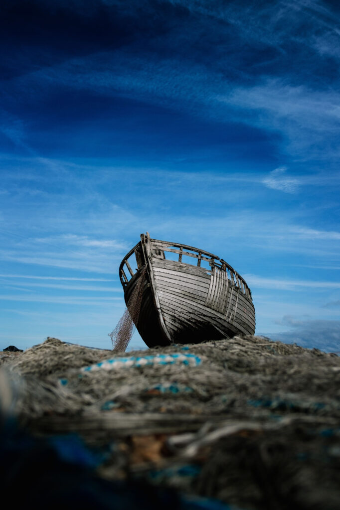
Beware to the “filthy four,” the bells toll for thee. Although two derelict marine structures bills—HB 1378 and SB 5433—passed through in the Washington Legislature in 2023, it is likely this year when Washington boaters will begin to see many of these blights on our waterways disappear.
The so-called filthy four is the nickname given to some of the most egregious examples of shoreline derelicts targeted for removal across the state in 2024 and 2025. The four sites that the Department of Natural Resources (DNR) lists as needing the speediest removal are:
- Triton-America Pier (Anacortes)—Built in 1914 and closed in 1998, this pier was the site of several cannery company operations.
- Dickman Lumber Mill (Tacoma)—Built in the 1890s, the mill site operated until 1974 and was slowly dismantled. While all decking is gone, there are still 1,200 creosote pilings in the water that need to be removed.
- Former High Tides Seafood Pier (Neah Bay)—Family owned and operated for more than 45 years, the pier served as a previous location for business operations.
- Ray’s Boathouse Pier (Ballard)—Well-known as one of Seattle’s best seafood restaurants, the business was temporarily closed through January for renovations.
“Washington’s waterfronts are littered with derelict structures that impede our efforts at salmon recovery while jeopardizing the health and safety of our communities,” said Hilary Franz, the state’s Commissioner of Public Lands. “We do tremendous work removing polluting creosote pilings, restoring nearshore environments, and keeping derelict vessels from damaging our vital habitat.”
Under the new legislation, a formal program has been created to remove these and other derelict structures from state-owned aquatic lands. DNR, which acts as a steward for more than 2.6 million acres of state-owned aquatic lands, will now use the $19.75 million that has been set aside in capital funding to move forward with the removal. DNR said it is now working with tribes, local governments, nonprofits, and other organizations to agree on a timetable.
Some of the most hazardous materials to be cleaned up at these derelict sites include creosote, asbestos, submerged tires, and other harmful chemicals that were regularly used in pier and artificial reef construction decades ago, before they were known to adversely affect the marine environment, leach into the water and sediments, and impede salmon recovery.
Besides the toxic mess of the chemicals at other sites around the state, the crumbling piers have created underwater navigation hazards for boaters, with many of the old timbers falling into the water at odd angles. “For healthy salmon and heathy communities, it’s critical that we get rid of them,” Franz added.
To keep abreast of the removal and clean-up of all these sites, visit: dnr.wa.gov.
[ port progress ]
Going Deep: Tacoma, Seattle to Make More Room for Larger Container Ships
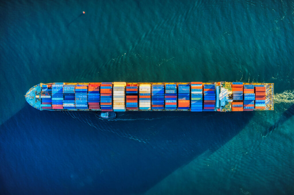
With most container ships today growing in size to achieve greater economies of scale, the ports of Tacoma and Seattle are both planning to grow right along with them with two waterway deepening projects. The expansions are both part of a comprehensive four-year modernization initiative for The Northwest Seaport Alliance (NWSA).
The two projects—the Tacoma Harbor Navigation Improvement Project and the Seattle Navigation Improvement Project—will keep pace with the ever-increasing size of trans-Pacific vessels, with most already large enough to carry 12,000 to 15,000 twenty-foot-equivalent units (TEUs) on every ocean crossing, and more vessels to come that are capable of 18,000 TEUs.
To remain competitive on the global ocean trade market, the two ports and NWSA are working with the U.S. Army Corps of Engineers to deepen both the Blair Waterway in Tacoma and the West Waterway Channel in Seattle to a depth that will be large enough to accommodate the 51-foot drafts of today’s Super Post-Panamax ships without needing to wait for high tides to complete the loading process.
Both expansion projects were approved in the U.S. Congress in 2018 and 2022 and are currently undergoing coordination with nearby tribes and other stakeholders, including the U.S. Coast Guard, Puget Sound Pilots, and the Washington State Department of Natural Resources.
In mid-December last year, the Port of Tacoma and the Corps created a design agreement to dredge the Blair Waterway navigation channel and to make minor footprint modifications for larger vessel transit, perform sediment characterization, and create ship simulations. A similar agreement between the Port of Seattle and USACE was finalized in September for the deepening of the West Waterway Channel, sediment characterization, engineering, and preparing of plans and specifications for the project.
Currently, the ports, NWSA, and the Corps are beginning design work on the waterway projects and the creation of deeper berth areas at their respective internationals containers terminals. Dredging is expected to begin next year and continue through 2029.
As a potential side benefit of the Blair Waterway program, some of the dredged material to be brought up from the bottom is being considered for use in a project to restore distressed salmonid habitat in Commencement Bay. The project, the East Commencement Habitat Opportunity (ECHO), formerly known as Saltchuk, will work with the Corps to determine whether the materials can be applied as fill for the ECHO site, which will create more than 20 acres of clean, intertidal riparian habitat on the waterway’s eastern shore. The project is also expected to help absorb wave action and mitigate erosion along Tacoma’s Marine View Drive.
Other marine improvement efforts in recent years along the Port of Tacoma’s Blair Waterway include the Husky Terminal Modernization project, a crane raising at the Pierce County Terminal, and new Super Post-Panamax cranes erected at Husky and Washington United Terminals. At the Port of Seattle, recent expansion investments focused on a modernization of Terminal 5, which strengthened the ship berths and added six new Super Post-Panamax cranes.
For more details on both projects, go to: nwseaportalliance.com.
[ closed for maintenance ]
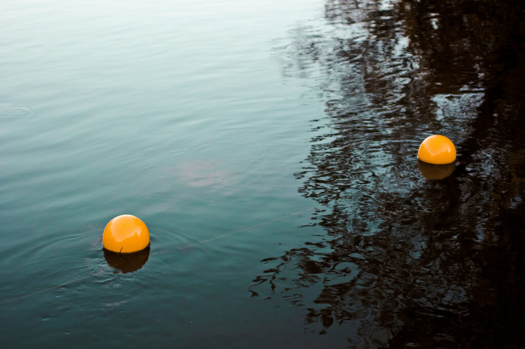
35 Public Moorage Buoys to Close for Replacement at 16 WA Parks
As we move closer to the true start of the 2024 boating season, expect to see fewer public moorage buoys at Washington State marine parks. Up to 35 buoys—or about 13.5 percent of the total 259 buoys maintained by the state park system—are being closed for damage this year and are slated to be replaced by early 2025.
In November 2023, The Washington State Parks and Recreation Commission identified public buoys at 16 of its 40 state parks across Western Washington that were either damaged or “at risk of breaking in the future.” Much of this damage is caused by prolonged exposure to saltwater and wave action that can lead to corrosion and anchor-chain breakage.
As a result, these recreational mooring buoys will be closed until further notice and will be replaced by modern helical screw-type anchors by the 2024/25 winter season, weather permitting. The commission also noted that most of the 16 marine parks affected by the closure will have several other operational mooring buoys for the public to use.
The hardest-hit parks with buoy closures will be Kopachuck State Park on Carr Inlet, which will see its one and only public moorage buoy closed, and Fort Flagler Historical State Park, which will have four of its five buoys closed. Other parks that will feel significant moorage impacts will be Mystery Bay (four out of six buoy closures), Potlach (three of five), Illahee (two of four), Twanoh (three of seven), Sequim Bay (two of six), Stuart Island-Reid Harbor (three of 11), and Blake Island (five of 26).
Other parks that will experience at least one buoy closure during the replacement project will be: Fort Townsend, Sucia Island (Fox Cove), Jones Island, Stuart Island (Prevost Harbor), Cutts Island, Fort Worden, and Clark Island. The total number of buoy closures, however, may fluctuate over the year, depending on the severity of weather and future wear and tear.
Once the replacement work is completed, the Parks Commission said the upgraded buoys will allow boats to tie up safely and limit their impacts on eelgrass, fish, marine mammals, and other shallow marine environments.
For more details, and to plan accordingly, go to: parks.wa.gov.
[ protecting the islands ]
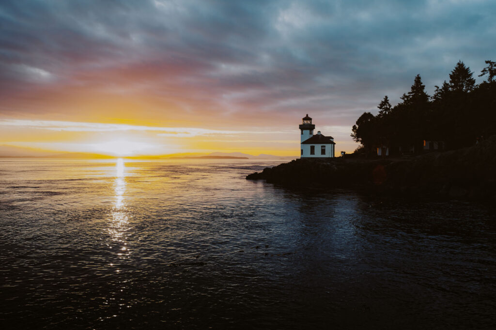
San Juan County Aims to Create Sustainable Management Plan, Considering Annual Tourism Fee
A growth management plan proposed last fall from San Juan County to regulate future development in the region has drawn some criticism from members of the boating community, including the Recreational Boating Association of Washington (RBAW), which said the plan places too many restrictions on boaters seeking access to the San Juan Islands. The preliminary draft of the San Juan Islands Destination Management Plan (SDMP) was released in summer 2023 to address the growth of tourism and increased pressures placed on the islands during the spring and summer months, when the seasonal crowds often double the local population. Public comment on the proposal continued through the end of October 2023.
Part of San Juan County’s proposal is to implement revenue-generating methods to help pay for efforts to handle the crush of seasonal tourism, such as a registration fee for boats (as well as cars and bikes) used on the island. These revenues would then be used for maintenance of marine facilities, moorings, and marine environmental protection efforts. Under SDMP’s planned action goals, San Juan County said it wants to implement a San Juan Island Boating Sticker program, which would require all boaters to purchase a permit for each vessel on the islands. The program, to be managed by the County Auditor’s Office, would be implemented in 2026, if finalized.
Additionally, the county said it plans to work with Washington State legislators to establish a Salish Sea Marine Pass program, which would be similar to the state’s current Discover Pass program that was created in 2011 to offset management costs of the Washington State Parks system. Under the Marine Pass proposal, the proceeds from fees would be used for the maintenance of marine facilities, moorings, and marine protection measures. The expected date of introduction of the pass program would be 2027, SDMP said.
In its list of regulatory priorities for the state’s 2023-2024 legislative session, RBAW cited its initial concerns that the proposed Marine Pass and boat sticker program “may prohibit and restrict boating and anchoring in the San Juan Islands.” These programs, the group said, add a “financial burden to boating in the area.” While RBAW called portions of SDMP noble in its attempt to lessen adverse impacts on the community due to overcrowding, it has submitted joint comments with industry stakeholders to voice concerns about the possibility of adding “new fees, stickers, passes, and anchoring restrictions in the plan.”
Marinas and ports in the San Juan Islands provide slips for about 1,940 boats, “but only a small fraction of slips are available for the influx of visiting boats during the boating season,” the report stated. Of the 1,863 mooring buoys surveyed for the SDMP, only about 120 buoys are for public use, most of which are scattered through the islands’ marine parks. “Recognizing that the number of boats throughout the Islands is greater than facilities available, there is likely significant physical disturbance to the marine bed, including indicator species such as eelgrass, via anchoring,” the SDMP report said.
According to survey data collected by the county in 2019 and presented in the report, most boaters identified marinas in the San Juans as “at capacity” (60%) or “over capacity” (35%) during peak summer season. The boating respondents in the survey suggested improved education efforts regarding etiquette for viewing marine life and increased docking and mooring opportunities would best address the problems of overcrowding and adverse marine environment impacts.
Some other proposed SDMP actions that would impact boating access include:
- Creation of additional recreation access (kayak launch amenities) and restoration at Jackson Beach on County Public Works property by 2025. This would also involve the removal of creosote pilings and shoreline armor that currently degrade the site.
- Assessment of environmental, cultural use, and social conditions at popular bays and access points by 2026. This would involve replacing some anchorages with public mooring buoys for rent to support sustainable destination access while protecting environmental and cultural resources.
- Adjustment of moorings on Sucia and Stuart islands based on mooring buoy condition analysis and carrying capacity around those islands by 2026. The county would also set a fee structure to encourage moorage use and eventual elimination of anchoring in sensitive bays.
- Establishment of a reservation system by 2027 for public mooring buoys in popular locations at densities that preserve the environment. The county would also develop and publicize overnight visiting boat counts.
In November, San Juan County said it had received more than 900 comments from islanders and other groups about the preliminary plan and will analyze the responses from the robust feedback for later consideration during the budgeting process for 2024/25.
For more details on the SDMP, go to: engage.sanjuancountywa.gov/destination-management-plan.