


In the mid-‘90s, I was living on Maui and teaching surfing to happily sunburned tourists. Late one afternoon, as we paddled out for a quick sunset session, a small sloop crested the horizon and picked its way through the reef, dropping anchor a hundred yards off shore. We caught a few waves and headed back to the beach, where we met the crew of this newly arrived boat.
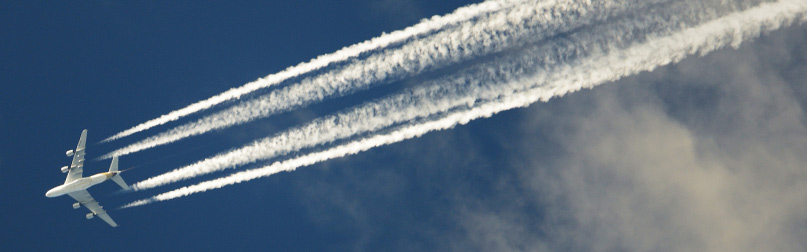
It turned out the three young men had bought their Catalina 27 in Long Beach, California, loaded it with canned chili and Gatorade, and headed southwest for Hawaii. The boat they purchased had no electronics, no radio, and just a few ratty sails. Running into the Hawaiian Islands was just an example of the pure dumb luck that 20-year-olds seem to find in this world. As they worked their way through our case of Heineken, I asked one of them how they managed to navigate to the islands. “It was easy,” he said. “We just followed the jet contrails.”
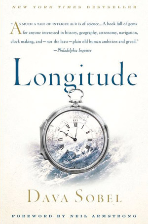
I think about those lucky idiots a lot. And as I sit onboard tonight, having just finished installing our new chartplotter, they are newly on my mind because I am settling in to read Dava Sobel’s wonderful book Longitude.
Those young men definitely played a risky hand, navigating by compass and following the occasional white line of exhaust in the sky above them. If they missed the Hawaiian Islands there was a good chance they would
have ended up dying of thirst somewhere in the South Pacific.
Take away the jet contrails, and they were taking the same risk early explorers took: setting sail over the horizon, making educated guesses as to where they were at any given time.
Latitude was relatively easy. As early as A.D. 150, Ptolemy figured that the zero-degree parallel was at the equator. Each line of latitude was separated by an even 15 degrees. Columbus and other early explorers sailed east to west by using the sun and stars to fix themselves on one parallel. It was longitude that presented the biggest challenge because each line of longitude could represent anywhere from 68 miles at the equator to essentially zero at the poles.
Determining longitude required a very complicated equation combining celestial observation, distance traveled, and two hyper-accurate time measurements: one at a fixed location and one onboard the ship. Celestial navigation was already understood. Distance logs were well sorted out. It was the accurate measure of time that would be the breakthrough mariners needed.
Sobel’s book beautifully tells the stories of the men whose often contradictory efforts led to our modern understanding of the imaginary lines that girdle the globe. We get the history and the science. And at each step of the development of understanding we see how these discoveries changed exploration, shipping, and warfare.
Prior to understanding longitude, for example, ships were bound to well-worn trade routes between known ports. This made for easy plunder: pirates merely waited at the tail end of a trade-wind path for laden ships to sail into their traps. These routes were also wildly inefficient, but deviating from them presented the very real danger of shipwreck or being lost at sea.
 In 1714, after a particularly embarrassing and deadly shipwreck, the English Parliament implemented the Longitude Act, offering a substantial prize for the solution to the longitude problem. Much as the cure for scurvy would greatly benefit the country that discovered it, understanding longitude would open the globe up and reap tremendous rewards for England.
Every time we reach port safely and on time we can thank an uneducated woodworker named John Harrison, who invented the first clock able to withstand the harsh conditions at sea while keeping accurate time. From his invention we gained not only the ability to safely and accurately navigate in open ocean but also time zones and modern mechanical clocks.
Longitude is simply a wonderful book that walks the reader through the science, politics, and beauty of the greatest navigational advancement in history. Once you have read it you will pause at every globe you see and marvel at the image on your chartplotter. It is a history lesson that lays bare how quickly we have gone from the dark ages of navigation to where we are today.