
![]() The year is flying by and with not much on the calendar for this weekend; we’ll just look at the big picture of weather and sneak a peek at the Memorial Day Weekend. Admittedly, looking out that far is fraught with danger, however why not? Nothing ventured, nothing gained or lost.
The year is flying by and with not much on the calendar for this weekend; we’ll just look at the big picture of weather and sneak a peek at the Memorial Day Weekend. Admittedly, looking out that far is fraught with danger, however why not? Nothing ventured, nothing gained or lost.


The surface forecast charts, as we have noted for the last couple of weekends, are beginning to show a consistent pattern of a weak ridge of high pressure along the coast acting to block the approach of weak low pressure systems with their attendant frontal systems. This is keeping our rainfall low and really making summer in California look a little scary because of existing drought conditions combined with an almost none existent snow pack and no relief in sight.
The other interesting feature that is popping up is the sea surface temperature anomaly chart which is showing not only a developing El Niño pattern but a strengthening blob of warm water off our coast which will serve to strengthen this almost permanent ridge of high pressure off of the coast. 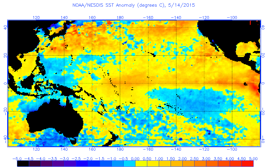 In the past when you have these features appearing together it has led to, shall we say, an enhanced hurricane and typhoon season. We’ve already had named systems in both the Pacific and Atlantic forming way ahead of the “normal” seasons for tropical disturbances. Note the 96-hour forecast chart showing a weakened Typhoon Dolphin at 30°N heading towards the Northwest. Luckily it’s heading into colder water which will hasten its weakening.
For the Swiftsure weekend you’ll notice on the FMNOC 180 hour forecast chart that this weak ridge will remain in place and keep the millibar spread over the Pacific Northwest spread pretty far apart.

Swiftsure surface forecast – early
Not a good sign however, as I’ve said, anything beyond 72 hours is notoriously inaccurate so keep your fingers crossed that that weak low pressure system. At 50°N and 175°W will somehow bang across the ridge and give us some breeze for Swiftsure.
Lots to think about and lots to keep track of if you’re heading out this weekend or just ready for our long Memorial Day Weekend.
Have a great weekend.