I’m afraid our lovely Indian summer has come to its inevitable conclusion with plenty of rain, cool temperatures and unstable air that resulted in yet another tornado and some lightning. All good stuff for you weather geeks. While the forecasters are responding to the marketing department by predicting a storm this weekend, it still doesn’t look all that bad. As usual it just depends on where you are in the Pacific Northwest.
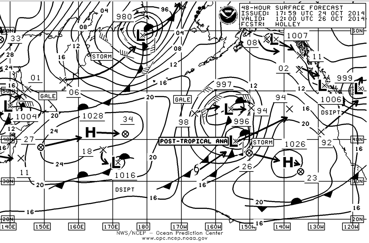
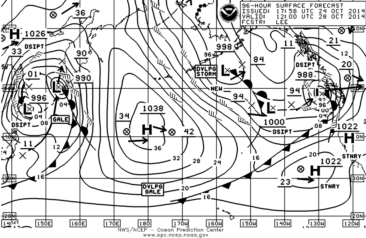
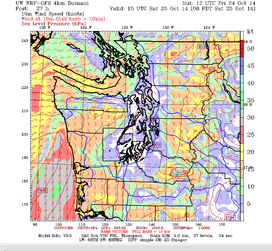
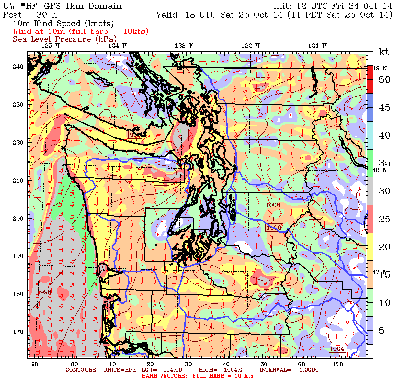
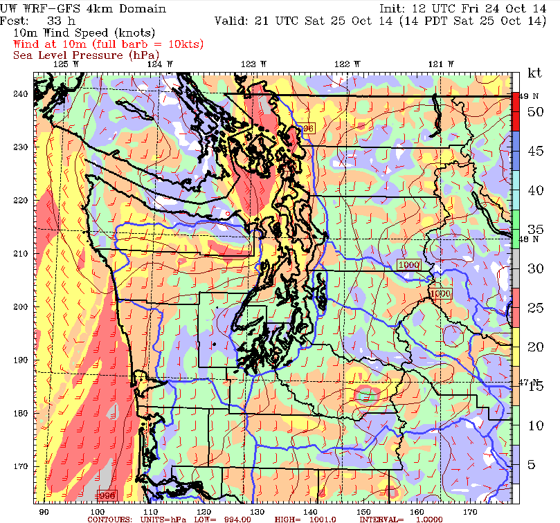
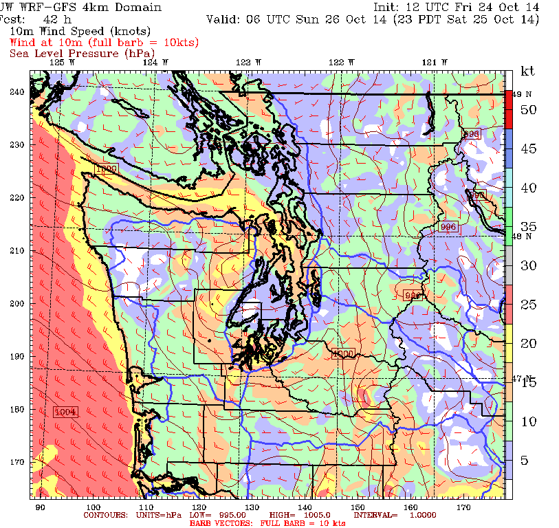
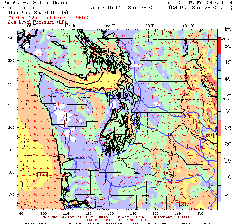
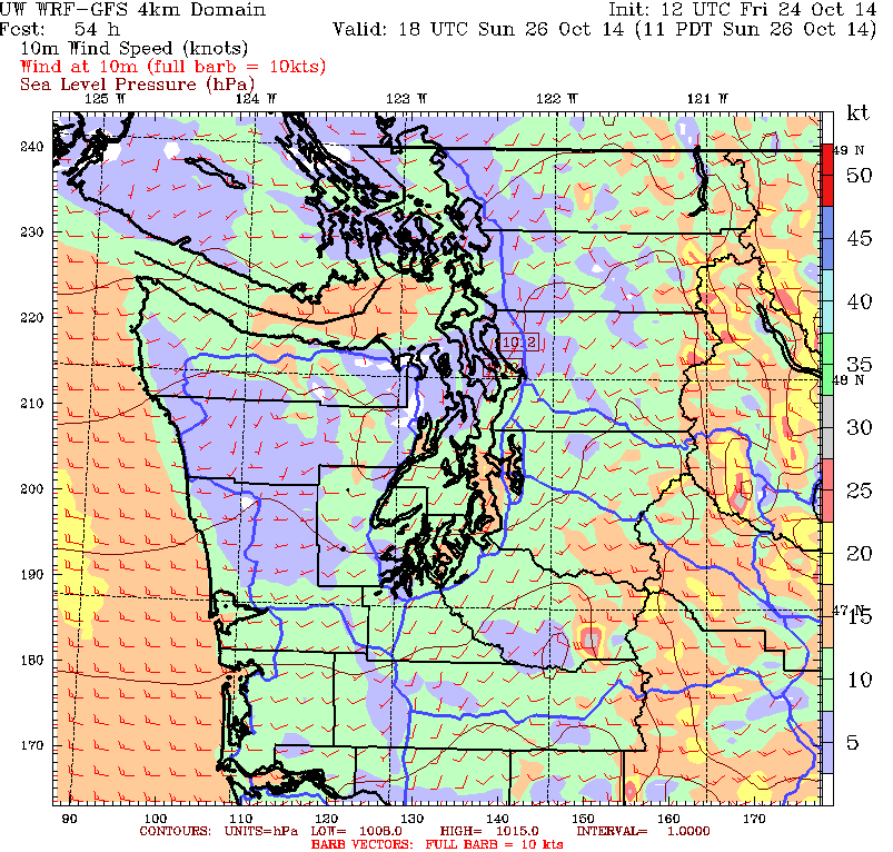
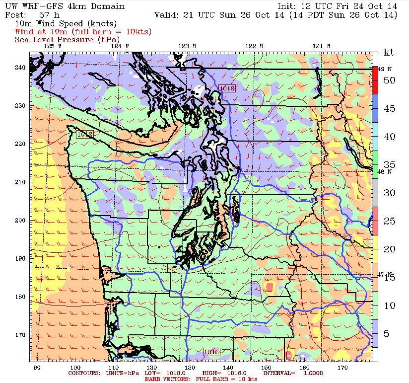
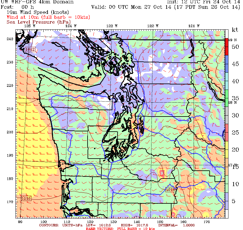
That brings up the point that while you should always have an eye on the weather, it is especially important this time of the year. As you can see from the surface charts there is a pretty active system headed our way Saturday and then it gets even more interesting on Sunday. The Sunday chart has a feature we talked about two weeks ago and we’ll discuss that later. The point is that if your boating is in the central Puget Sound, the weather there can be dramatically different than say the south Sound or the San Juan Islands. So take advantage of the great charts available at the Univ of Washington MM5 site and check conditions before you go anywhere.
Click on any picture to enlarge.
The best chart to exemplify this state of regional variances in the weather is the 1100 chart for Saturday. The center Sound shows 5-10 knots from the southeast while south Sound shows 15+ from the south while eastern end of the Juan de Fuca Strait shows 30+knots from the southeast. Along the coast from Westport to Destruction Island you’ve got 35-40 knots from the south. Notice also that the easterly in the Straits goes clear out to the entrance to the Straits. This is the pre-frontal situation so it’s not going to last and by 1400 the front has gone past the coast and into the interior of Western Washington with the wind on the coast going from 35-40 knots from the south to 25-30 knots from the north-northwest. By 1700 the wind in the western and central Straits is now a solid 15-20knots from the west and along the coast its 15-20 knots from the north-northwest with much stronger breeze off the mouth of the Columbia River. In the South Sound the wind will have backed off to 10-15 from the south-south southwest while the Central Sound will now have 20-25 from the south-southwest.
By 2300 on Saturday night the westerly has filled all the way down the Straits as well as down Admiralty Inlet and into Puget Sound while the northwesterly on the coast is spilling through the Chehalis gap and into south Sound. And this will form??? All together now and I don’t want to see the same hands out there: The classic Puget Sound Convergence Zone!
Sunday we’ll be looking at direct onshore flow which keeps the convergence zone in place staying just north of Everett. Center Sound will have a reasonably consistent 10-18 knots from the south-southwest with some higher puffs while the flow down the Straits will stay at around 20 knots until late in the day.
Let’s go back now and look at the Sunday, 48-hour surface forecast chart. Remember a couple of weeks ago we were talking about Hurricane Ana and what might happen to it? Well, sure enough, it has become a post-tropical depression and it is aiming right at the Pacific Northwest with landfall sometime late Tuesday or early Wednesday. Not unlike the Columbus Day storm of 1962. The main difference is that in 1962 it went up the coast and then into BC. This looks to come directly onshore but still with some pretty good breeze, so we should watch this as it develops.
Click on any picture to enlarge.

Since it’s the weekend, it would probably be a great time to get the winter mooring lines out, get chafe gear in place at the chocks, and think about doubling up the mooring lines that will take the breeze from the south. It would also be a great time to take down your roller furling sails and get them into the sailmaker for cleaning and maintenance. When the breeze comes up and gets into a roller furling jib that has been left up, bad things can happen not only to you but your neighbor downwind.
The 27th-28th– and 29th will also be the time of the high tides and when high tides are concurrent with high wind it’s another opportunity for the best laid plans to go astray. So if your mooring is susceptible in those conditions, be warned.
If this does look like it could develop into a high wind advisory we’ll but out a more detailed forecast as it closer.
Have a great weekend.


