Has it been wet enough for you yet? So as of today we’ve had almost 6.5 inches of rain for the month of September compared to 1.52 inches which is the average amount we usually receive. Year over year we are now over 10 inches of rain ahead for the year and it doesn’t look like it’s going to get any drier. In fact if you remember this last Spring and the rainfall that resulted in the disastrous Oso landslide, and since the Northwest is mostly built on glacial till, there may be more slides this fall. Remember also that November is traditionally our wettest month and as we talked about last week, conditions are setting up for a warmer and wetter winter.
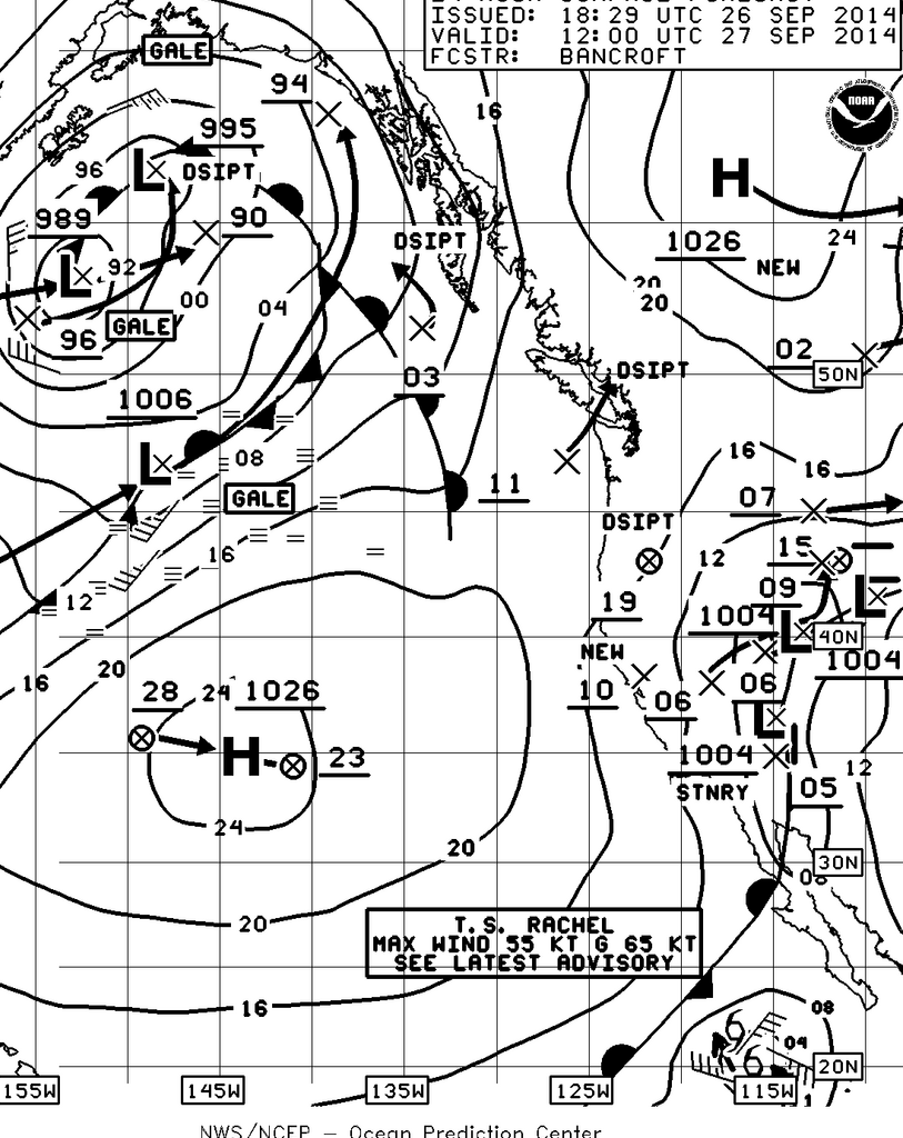
NOAA’s 24-hour Surface Chart.
So what about this weekend? All in all, it should be spectacular as this series of weak systems will move east leaving us between five low pressure systems and two relatively weak high pressure systems. The 48 hour chart is even more interesting as the North Pacific finds itself home to six low pressure systems including one tropical storm (Rachel, named after my niece I’m sure) and one typhoon, Kammuri. It also unfortunately shows what we will be in for next week as that 990 MB low in the Gulf Alaska with its attached cold front will sweep over us on Monday and Tuesday adding to our already record rainfall for September.
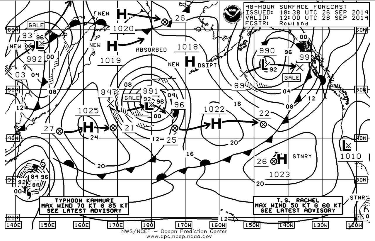
NOAA’s 48-hour surface chart.
As far as wind goes, you can tell by the spacing of the isobars there isn’t going to be much. A better weekend for powerboaters and paddleboarders than sailors. There may be a slight increase in the northerly breeze in the central Sound on Saturday afternoon where the amount it will increase will depend upon how much clearing there is over Seattle and when that clearing occurs. The increase in the northerly wind velocity will be somewhat helped by the small flood of the day that will start about 1330 hours on Saturday.
Cabo San Lucas and Baja California Sur just can’t seem to catch a break this hurricane season. Tropical Storm Rachel has formed and while it is weakening it may just become stationary off to the south and west of Cabo and with its counter-clockwise rotation just send more rain into that area. It will probably not make a direct hit so again it won’t be the wind that will be the problem, it will be the rain and that will simply cause more slides and slow the recovery and rebuilding efforts. The long range outlook for the eastern Pacific show that conditions continue to be excellent for more tropical storm development so keep an eye on that area to the south and east of the Gulf of Tehuantepec.
Enjoy the weekend and next week is the first of the major fall races with Edmonds Double Bluff Race and we’ll have a race specific analysis for you on Friday the 3rd of October. We’ll also have a post race review for you, hopefully on Monday.