
I installed this app on my Android and gave it a brief test-drive. After an initial hiccup on installation, it started working well. Basically, it allows you to wander around on a map/chart/photo with public facilities called out clearly on the screen. Tap on a given icon and you get a bit more information. It appears many private facilities are listed as well.
While this app is certainly a good thing to have at your fingertips, the information it provides is not very detailed, and of course only time will tell how well the information stays current. However, it’s useful if for no other reason than just getting a visual on what’s available. With photo numbers and websites in the listing, it’s a pretty short step to get all the current information on a given spot.
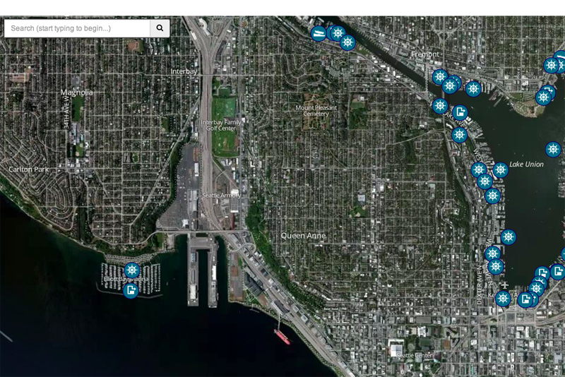
I particularly liked the the aerial photographic view, as it seemed to give me a better sense of an unknown port than a street or chart view would.
Keep your charts handy and keep some good old printed cruising books and guides around. But this is another useful tool for making the best use of Washington waters. Following is the information from the Smartmine site, and a demo is available at watercruiser.smartmine.com. –KH
Boaters who want more information about where to launch their boats or tie up for a weekend on the water can do so now through Washington Water Cruiser, a new app launched by the Washington State Recreation and Conservation Office (RCO). – See more at: http://www.geoengineers.com/news/smartmine-develops-boating-app-washington-state-recreation-and-conservation-office#sthash.hCXV9iJd.dpuf
The free app is available for both Apple and Android mobile devices, and has a web-based version. It maps all state-owned boat launches and moorage sites open to the public, along with amenities for boaters at each site.
“This app brings together information from three state agencies,” said Kaleen Cottingham, director of the Recreation and Conservation Office. “It has information on boat launches, moorage slips and pumpout locations, in both eastern and western Washington, from the Washington Department of Fish and Wildlife, Washington State Parks and Recreation Commission and the Recreation and Conservation Office.”
The map-based app was created by SmartMine, the technology development team at GeoEngineers, using a grant RCO received from the U.S. Fish and Wildlife Service. It provides aerial, street map and nautical chart views for boaters throughout the state.
“This app will be really helpful to a lot of boaters,” said George Harris, president of the Northwest Marine Trade Association, the nation’s largest regional marine association. “In the past, you’d have to carry a couple of cruising manuals or visit several websites to plan an outing. Now, you can see the information you need on your smart phone or tablet while you’re on the water.”
– See more at: http://www.geoengineers.com/news/smartmine-develops-boating-app-washington-state-recreation-and-conservation-office#sthash.hCXV9iJd.dpuf